|
Durlston Bay / Studland Bay / Poole Harbour / Poole Bay / Christchurch Harbour / Christchurch Bay / Hurst Spit / Swanage Bay
Swanage
Bay (SWA)
 Peveril Point to Handfast Point Peveril Point to Handfast Point
The southern half of this frontage includes
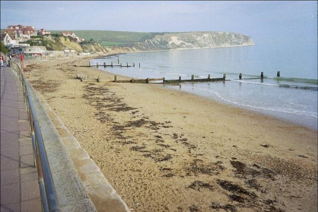
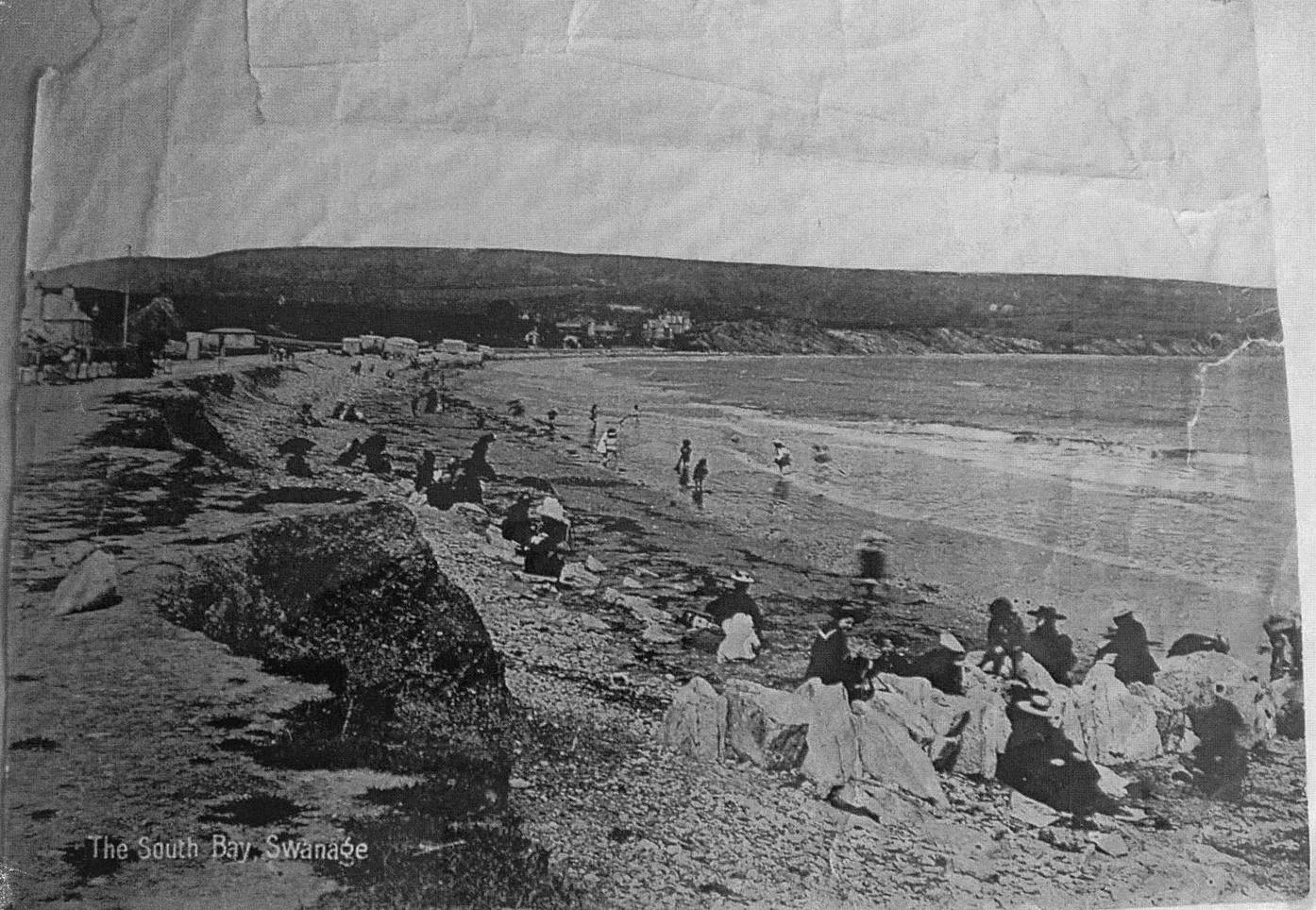
Swanage Bay and the town of Swanage. This is a popular recreational
area for beach users, diving, fishing and sailing.
The
town has been developed on soft eroding cliffs and annual falls & slips
have left some properties, such as The Pines Hotel, very close to the
cliff top.
Timber groynes were first constructed in 1925;
eighteen of them were reconstructed in 2005/06 at the same time as the beach
was replenished - an operation that made beneficial use of sediment
dredged during essential works to Poole Harbour's port and approach
channels (see
www.poolebay.net for further information).
The extreme southern part of this frontage
includes Swanage Pier, a sewage treatment works and coastguard station.
Moving north beyond the groynes the coast is undeveloped and undefended.
From Ballard Point through to Handfast Point the coastline is
characterised by actively eroding vegetated chalk sea cliffs. This
area is best known for the stacks, caves and chalk arches with "Old Harry
Rocks" at the northern most point.
The coastline of the bay is of national and
international ecological and geological importance (the occasional
dinosaur remains have been found in the alluvial chalk strata) and the
landscape is of high intrinsic value. A bowl barrow and two round
barrows (Scheduled Monuments) lie east of Ballard Down, close to the cliff
edge.
The frontage is highly designated:
|
 |
Dorset & East Devon World Heritage Site |
|
|
Isle of Portland to Studland Cliffs SAC
|
|
|
Studland Cliffs SSSI |
|
|
Purbeck Ridge SSSI |
|
|
West Dorset Heritage Coast |
|
|
Dorset AONB |
|
|
AONB
- Area of Outstanding Natural Beauty. SAC - Special Area of
Conservation. SSSI - Site of Special Scientific Interest |
Swanage Bay faces east and is protected by
Peveril Point from major southwesterly storms. The Isle of Wight provides
a degree of shelter from easterly storms.
Construction of the outfall jetty in 1993, at
the southern end of the bay, obstructed sediment transport and resulted in
falling beach levels immediately to the north. Although this was
offset by considerable accumulation of beach material to the south, the
2005/06 groyne replacement and beach recharge project has since addressed
the problem.
Beach modelling has shown that the effect of the
outfall structure as a groyne precludes the need to replace the two
groynes to the south of the outfall jetty which were removed during the
recharge scheme.
Coastal management issues here include:
-
The potential impact of any coastal defence
works on
Swanage's tourism, inshore fisheries, offshore wrecks, archaeological
value and the aesthetic and landscape quality of the coastline.
In SMP1 the shoreline of
Swanage Bay is divided into 5 Management Units:
|
Process Unit |
Management
Unit |
Description |
|
SWA |
SWA1 |
Peveril Point to Swanage
Pier |
| |
SWA2 |
Swanage Pier to Outfall
Jetty |
| |
SWA3 |
Outfall Jetty to Sheps
Hollow |
| |
SWA4 |
Sheps Hollow to Ballard
Point |
| |
SWA5 |
Ballard Point to Handfast
Point |
Administrative Responsibility
Purbeck District Council
|


.JPG)