|
Durlston Bay / Studland Bay / Poole Harbour / Poole Bay / Christchurch Harbour / Christchurch Bay / Hurst Spit / Swanage Bay
Poole
Harbour & Islands (PHB)
 South
Haven Point to North Haven Point South
Haven Point to North Haven Point
Managed by Poole Harbour Commissioners, Poole
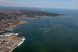
Harbour is a large natural estuary, 38km2 in area. It is
comprised of separate channels, bays and inlets, which combine to produce
a 100km long section of enclosed coastline.
Its extensive mudflats, salt
marshes, reedbeds, sand dunes, heathland and islands are of great importance to wildlife and bird
populations, many of which are protected by a raft of national and
international conservation designations, but which could easily be damaged
by inappropriate coastal defences.
Many of these areas are afforded protection by National, European and International designations, including:
|
 |
Dorset & East Devon World Heritage Site |
|
|
Dorset Heathlands Ramsar Site |
|
|
Poole Harbour Ramsar Site |
|
|
Dorset Heaths Purbeck & Wareham & Studland
Dunes SAC |
|
|
Dorset Heaths SAC |
|
|
Poole Harbour SPA |
|
|
Dorset Heathlands SPA |
|
|
Poole Harbour SSSI |
|
|
Arne SSSI |
|
|
The Moors SSSI |
|
|
Hartland Moor SSSI |
|
|
Ham Common SSSI |
|
|
Holton & Sandford Heaths SSSI |
|
|
Luscombe Valley SSSI |
|
|
Rempstone Heaths SSSI |
|
|
River Frome SSSI |
|
|
Studland & Godlingston Heaths National
Nature Reserve |
|
|
West Dorset Heritage Coast |
|
|
Dorset AONB |
|
|
AONB - Area of
Outstanding Natural Beauty. SAC - Special Area of Conservation.
SPA - Special Protection Area. SSSI - Site of Special Scientific Interest |
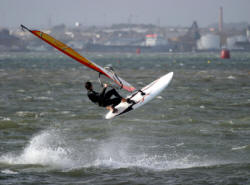
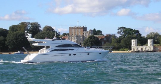
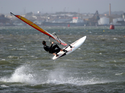
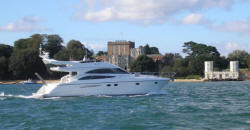 The Harbour is a popular destination both with
tourists and recreational water users. Yachting, water skiing,
windsurfing, kitesurfing, wildfowling and the use of personal watercraft
need to be managed to minimise conflict and to reduce disturbance to
ecologically sensitive areas. The Harbour is a popular destination both with
tourists and recreational water users. Yachting, water skiing,
windsurfing, kitesurfing, wildfowling and the use of personal watercraft
need to be managed to minimise conflict and to reduce disturbance to
ecologically sensitive areas.
Four rivers (the Frome, the Piddle, the Corfe
and the Sherford) drain into the Harbour from the west; the largest of
these are the River Frome and River Piddle at Wareham. The tidal
limit of the River Frome lies just upstream of Wareham, whereas the tidal
limit of the Piddle lies just downstream of the town.
The entrance to Poole Harbour is just 300m wide.
A chain-link ferry operates across it, defying the strong tidal currents.
In order to maintain the economic viability of the Port it was recently
necessary to deepen the Harbour approach channels from 6m to 7.5m below
chart datum and to widen the middle ship channel to 100m.
Approximately 1.1 million cubic metres (1.65 million metric tonnes) of
sand was dredged and used to replenish the beaches at Poole, Bournemouth
and Swanage (see
www.poolebay.net for further information).
The port is located 4 miles north-west of the
Harbour entrance. It is an important local and
regional asset, which makes a significant contribution to the economy of
the area. There are approximately 100 registered fishing boats based
at the port and sections of the seabed are used for the cultivation of
shellfish. The Harbour is also home to Europe’s largest onshore oilfield.
In addition there is a significant area of light industry at Hamworthy &
Holes Bay. The largest private sector employers in the County
(Sunseeker) construct luxury motor craft at their factory on the side of
Back Water Channel. There are also a number of yacht clubs, several
thousand moorings and an MOD base along the northern side of the Harbour.
 These many uses must be carefully managed to
avoid conflicts of interest, but possibly the most significant long-term
trend affecting Poole Harbour is sea level rise. The predicted sea level
rise for the Solent area is around 35cm by 2050 and climate change is also
expected to affect the incidence of storms and extreme water level events.
Many of the important areas of habitat are located on low-lying or
inter-tidal land which is sensitive to the effects of climate change and
sea level rise. These many uses must be carefully managed to
avoid conflicts of interest, but possibly the most significant long-term
trend affecting Poole Harbour is sea level rise. The predicted sea level
rise for the Solent area is around 35cm by 2050 and climate change is also
expected to affect the incidence of storms and extreme water level events.
Many of the important areas of habitat are located on low-lying or
inter-tidal land which is sensitive to the effects of climate change and
sea level rise.
Coastal structures in the Harbour are generally
restricted to the developed northern side, predominantly in the form of
seawalls, with revetments and breakwaters at a few locations and mudflats
generally characterising the foreshore. Sections of the western
flanks of the Harbour and riverbanks are protected by embankments.
Rockley Caravan Park is situated on a soft sandy cliff on the north of the
Harbour at Rockley Point; although defended in places the park suffered a
landslip in March 2008.
Coastal management issues at Poole Harbour
include:
-
The potential impact of any coastal defence
works on the Harbour's wildlife habitats and ecology, navigation, public
access to the shoreline, inshore fisheries & shellfish grounds, maritime
archaeology and recreational value.
-
Strategic coastal defence options should be
able to adapt to sea level rise without compromising life and property.
In SMP1 the extensive
shoreline of Poole Harbour is divided into 17 Management Units:
|


.jpg)